Technology
What it’s like to walk with Google Maps in augmented reality

I’m walking down San Francisco’s Market Street toward a coffee shop using Google Maps when giant arrows pop up on my phone.
I’m supposed to turn right on Front Street. The directions are hard to miss in the new Google Maps . The large animated arrows make it clear with a glance which direction I should head. It looks something like this:

The feature came out Monday for select “local guides” who add new locations, rate businesses, take photos, and more for Google Maps. It’ll be on more guides’ phones in the coming days, although regular users shouldn’t expect it soon. For now, it’s being tested for feedback, and the look and feel of the feature is expected to change. It’s also strictly for walking directions — not for driving.
Back on my walk to coffee, I’m in the middle of what’s often referred to as an “urban canyon.” These are places where GPS can fail you as your positioning ricochets off buildings, pipes, cell towers, and more. Yes, you have full service and data is working, but locating you precisely is a challenge. So instead of pinpointing your exact location, the phone thinks you’re a block over. Then there’s the orientation issue — when Google Maps can’t tell which direction you’re heading or facing.

So connected, but so lost.
So when I take out my AR-enabled Google Maps app, it uses the camera to scan buildings, street layouts, even the foliage and street art to determine exactly where I am. I started off on my coffee-bound journey at the “Cupid’s Span” sculpture on the Embarcadero bayside waterfront. This is a permanent structure that Google Maps knows from over 10 years of Street View imagery and data collection. Once it sees that the sculpture is on my left and the Ferry Building is up ahead, a blue arrow is superimposed over the screen, directing me to walk forward.
Off I go.
AR maps directions aren’t meant for constant use. In fact, the phone displays a message if you hold up your phone for too long: “For your safety put the phone down as you walk.” It’s meant for “moments of usefulness,” as one of the Google Maps product managers tells me at the Monday morning demo walk.
As I put the phone down it reverts to its usual 2D map with my blue trail marking where I should head. If I get confused or want to make sure I’m on the right path, I can hold up the phone again and it re-scans my new surroundings and tells me how many more feet until my turning point. Emerging from a subway station or a building, it can orient you pretty instantly.
As a San Francisco native the step-by-step instructions aren’t that useful, but it is pretty fun. It reminds me of a racing video game in real-time and at walking pace. Or a Snapchat filter with useful information instead of vomiting rainbows. But as a traveler in a new city or for the countless tourists navigating SF’s hilly streets, this could be clutch. In a quick moment you get oriented and your phone is in sync with you. This could be the end of asking strangers which way to go.


Zomato’s quick commerce unit Blinkit eclipses core food business in value, says Goldman Sachs

Monsta X’s I.M on making music, gaming, and being called ‘zaddy’

Petlibro’s new smart refrigerated wet food feeder is what your cat deserves

The books on your favorite creators’ TBR shelf

Xaira, an AI drug discovery startup, launches with a massive $1B, says it’s ‘ready’ to start developing drugs

Rabbit R1 hands-on review: Something is iffy about this

UK probes Amazon and Microsoft over AI partnerships with Mistral, Anthropic, and Inflection

‘Shōgun’ co-creators break down the finale: ‘It’s a story about death’

Tesla’s new growth plan is centered around mysterious cheaper models

Tesla’s in trouble. Is Elon Musk the problem?

API startup Noname Security nears $500M deal to sell itself to Akamai

US think tank Heritage Foundation hit by cyberattack

NASA discovered bacteria that wouldn’t die. Now it’s boosting sunscreen.

How to watch ‘Argylle’: When and where is it streaming?

Tesla drops prices, Meta confirms Llama 3 release, and Apple allows emulators in the App Store

Tesla layoffs hit high performers, some departments slashed, sources say

TechCrunch Mobility: Cruise robotaxis return and Ford’s BlueCruise comes under scrutiny

Meta to close Threads in Turkey to comply with injunction prohibiting data-sharing with Instagram

Former top SpaceX exec Tom Ochinero sets up new VC firm, filings reveal

Consumer Financial Protection Bureau fines BloomTech for false claims
Zomato’s quick commerce unit Blinkit eclipses core food business in value, says Goldman Sachs
Monsta X’s I.M on making music, gaming, and being called ‘zaddy’
Petlibro’s new smart refrigerated wet food feeder is what your cat deserves
The books on your favorite creators’ TBR shelf
Xaira, an AI drug discovery startup, launches with a massive $1B, says it’s ‘ready’ to start developing drugs
Rabbit R1 hands-on review: Something is iffy about this
UK probes Amazon and Microsoft over AI partnerships with Mistral, Anthropic, and Inflection
‘Shōgun’ co-creators break down the finale: ‘It’s a story about death’
Tesla’s new growth plan is centered around mysterious cheaper models
Tesla’s in trouble. Is Elon Musk the problem?
-

 Business7 days ago
Langdock raises $3M with General Catalyst to help businesses avoid vendor lock-in with LLMs
-
 Entertainment7 days ago
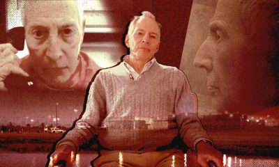
What Robert Durst did: Everything to know ahead of ‘The Jinx: Part 2’
-

 Entertainment6 days ago
This nova is on the verge of exploding. You could see it any day now.
-

 Business6 days ago
India’s election overshadowed by the rise of online misinformation
-
 Business6 days ago
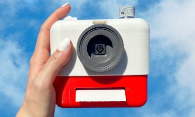
This camera trades pictures for AI poetry
-
 Business7 days ago
CesiumAstro claims former exec spilled trade secrets to upstart competitor AnySignal
-
 Business4 days ago
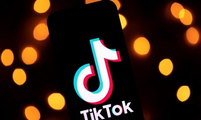
TikTok Shop expands its secondhand luxury fashion offering to the UK
-
 Business6 days ago
Boston Dynamics unveils a new robot, controversy over MKBHD, and layoffs at Tesla