Technology
Google’s natural disaster alerts will soon come with more visual detail

Google’s SOS alerts are a handy tool to keep people informed in times of crisis, and now they’ll come with even more detail.
In the next few weeks, Google will begin to present more visual information for natural disasters, plus introduce a new navigation warning system.
For hurricanes, Google Maps will display a forecast cone which will show the hurricane’s projected trajectory, with information on the times it’s expected to hit certain areas.
If you’re near the hurricane, a crisis notification card will alert you of the information in the days leading up to it.
In the aftermath of an earthquake, a shakemap will display its epicenter and its magnitude, while color coding will detail the intensity of the shaking in surrounding areas.
Google is also rolling out flood forecasting, which will be first tested in the flood-prone city of Patna in India, before arriving in the Ganges and Brahmaputra regions. It’ll tell users where flooding is expected to hit, as well as its expected severity.
You don’t need to be near these locations to see all this. Simply using Google to search the name of the area where the natural disaster will or has affected will give you that visual information.
Another neat feature is crisis alerts during navigation on Google Maps, which will warn people if a natural disaster may affect their trip, and it’ll try and navigate them away from the disruption.

Google Maps’ new navigation warning system.
As before, you can share this crisis information with friends and family, share your location, and also see and report road closures. Nice one.


Petlibro’s new smart refrigerated wet food feeder is what your cat deserves

The books on your favorite creators’ TBR shelf

Xaira, an AI drug discovery startup, launches with a massive $1B, says it’s ‘ready’ to start developing drugs

Rabbit R1 hands-on review: Something is iffy about this

UK probes Amazon and Microsoft over AI partnerships with Mistral, Anthropic, and Inflection

‘Shōgun’ co-creators break down the finale: ‘It’s a story about death’

Tesla’s new growth plan is centered around mysterious cheaper models

Tesla’s in trouble. Is Elon Musk the problem?

Two widow founders launch DayNew, a social platform for people dealing with grief and trauma

Google Pixel 9 and Pixel 9 Pro: Release date, specs, new features, and other rumors

API startup Noname Security nears $500M deal to sell itself to Akamai

US think tank Heritage Foundation hit by cyberattack

NASA discovered bacteria that wouldn’t die. Now it’s boosting sunscreen.

How to watch ‘Argylle’: When and where is it streaming?

Tesla drops prices, Meta confirms Llama 3 release, and Apple allows emulators in the App Store

Tesla layoffs hit high performers, some departments slashed, sources say

TechCrunch Mobility: Cruise robotaxis return and Ford’s BlueCruise comes under scrutiny

Meta to close Threads in Turkey to comply with injunction prohibiting data-sharing with Instagram

Former top SpaceX exec Tom Ochinero sets up new VC firm, filings reveal
Tesla layoffs hit high performers, some departments slashed, sources say
Petlibro’s new smart refrigerated wet food feeder is what your cat deserves
The books on your favorite creators’ TBR shelf
Xaira, an AI drug discovery startup, launches with a massive $1B, says it’s ‘ready’ to start developing drugs
Rabbit R1 hands-on review: Something is iffy about this
UK probes Amazon and Microsoft over AI partnerships with Mistral, Anthropic, and Inflection
‘Shōgun’ co-creators break down the finale: ‘It’s a story about death’
Tesla’s new growth plan is centered around mysterious cheaper models
Tesla’s in trouble. Is Elon Musk the problem?
Two widow founders launch DayNew, a social platform for people dealing with grief and trauma
Google Pixel 9 and Pixel 9 Pro: Release date, specs, new features, and other rumors
-

 Business6 days ago
Langdock raises $3M with General Catalyst to help businesses avoid vendor lock-in with LLMs
-

 Entertainment6 days ago
What Robert Durst did: Everything to know ahead of ‘The Jinx: Part 2’
-

 Entertainment5 days ago
This nova is on the verge of exploding. You could see it any day now.
-

 Business5 days ago
India’s election overshadowed by the rise of online misinformation
-
 Business5 days ago
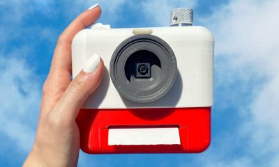
This camera trades pictures for AI poetry
-

 Business6 days ago
CesiumAstro claims former exec spilled trade secrets to upstart competitor AnySignal
-

 Business4 days ago
TikTok Shop expands its secondhand luxury fashion offering to the UK
-

 Business7 days ago
Internet users are getting younger; now the UK is weighing up if AI can help protect them