Entertainment
Extreme polar cold is about to pummel the U.S. over the holidays

This holiday season, the Arctic is gifting big parts of the U.S. extremely frigid temperatures.
The National Weather Service expects that giant swathes of the nation will experience freezing or dangerous conditions over the coming week, with some places seeing their coldest temperatures in decades. Overall, cold polar air will drop south into the Central U.S. on Wednesday, Dec. 21 and continue driving into the Eastern U.S. on Friday and Saturday. What’s more, a major blizzard will slam the Midwest between Dec. 21-25.
Expect wild drops in temperature. For example, the NWS predicts the high temperature in Denver on Wednesday will be 46 degrees Fahrenheit. That will drop to around minus 1 F on Thursday. Meanwhile, temperatures in the New York City area will be in the 40s and 50s Friday morning, but will plummet to around 20 degrees or colder later that day. In some places, wind chill temperatures (the air temperature as it would feel blown on skin) are just bonkers: In Wyoming on Wednesday night through Thursday many temperatures will be well below minus 50 F.
“It’s tremendous temperature changes across a 24-hour period,” Bob Oravec, a lead forecaster with the National Weather Service in College Park, Maryland, told Mashable. “Really cold air will displace relatively mild air.”
Check your local NWS office for more region-specific weather updates. National and local NWS updates on Twitter are still valuable, easily-digestible sources of information, even as Twitter itself struggles with incoherence and absurdity.
You’ll probably want to take a hard look at your holiday travel plans, too. Some areas will have blizzards; others high, cold winds. “Dangerous cold will continue through the holiday weekend,” tweeted the National Weather Service office in Chicago.
“Very impactful weather is coming up over the next several days,” noted Oravec. “I imagine there will be a lot of airline delays.”
“It’s tremendous temperature changes across a 24-hour period.”
On the NWS weather map below, you can see the cold air moving south and east across the U.S. this week, through December 24. The colors show temperature departures from normal (meaning climatic averages over the last 30 years). Blue is a dominant shade on these maps, meaning temperatures some 20 to 40 degrees below normal (depending on the shade).
What’s driving the extreme polar cold
During some winters, Arctic air spills southward into the U.S. That’s what’s happening here.
You’ve probably heard of the jet stream: It’s an extremely influential band of powerful winds that separates colder northern air from warmer southern air, somewhat like a barrier, up near where commercial planes fly. It travels west to east. But sometimes, large scale weather events perturb this stream of air, causing it to meander wildly north or south. When it falls south, it opens the Arctic’s refrigerator door, allowing unusually cold Arctic air to spill southward.

A graphic showing how the meandering jet stream separates cold air from warmer air.
Credit: NOAA
Some years, the Arctic’s polar vortex — strong winds that circle westward around the pole during winter — can play a role in nudging or destabilizing the jet stream, letting cold air move south. In the current case, as the jet stream bent downwards, parts of the polar vortex lower in the atmosphere are moving and reforming farther south, explained Oravec. This allows “a big chunk of cold” to move over parts of the U.S., he added.
Importantly, intense winter freezes will still happen in a heating world. Earth is heating relentlessly, and winter is the fastest-warming season, according to National Oceanic and Atmospheric Administration data compiled by Climate Central, an independent organization that researches climate change. But dynamic weather moving through our profoundly chaotic atmosphere will frequently still have opportunities to spill Arctic air into the Lower 48.
Extreme cold spells won’t disappear. “A warming world is still one where we have many types of weather events. We’ll still have cold snaps,” climate scientist Zeke Hausfather told Mashable last year following the extreme freezes in Texas.
“A warming world is still one where we have many types of weather events. We’ll still have cold snaps.”
A hot area of continued atmospheric research, however, is if climate change is making Arctic cold air outbursts more likely. As Mashable previously reported: Some research has suggested the possibility that as the Arctic rapidly warms, it can make weather extremes more likely: Specifically, the heating Arctic might make the jet stream more prone to meandering north or south, kind of like a loose, droopy rope. This could, for example, allow polar air to more easily swoop down from the Arctic. But other research hasn’t found such a link.
What’s certain, however, is Arctic air is on its way to impact much of the country this holiday season. Take it seriously (nearly a quarter of U.S. car crashes happen on snowy, wintery roads). Be ready.


The greatest films on Prime Video right now

ICONIQ Growth raises $5.75B seventh flagship fund

Apple Watch Series 9 vs. SE: A smartwatch skeptic tested both for 13 days

Google dubs Epic’s demands from its antitrust win ‘unnecessary’ and ‘far beyond the scope’ of the verdict

Apple: pay attention to emerging markets, not falling China sales

Greatest Star Wars Day deals and new releases 2024: Shop May the 4th sales

Danti’s natural language search engine for Earth data soars with $5M in new funding

5 essential gadgets for turning your home into a self-care sanctuary

Haun Ventures is riding the bitcoin high

Hands-on with the Claude AI app: It’s pleasant to use, but janky

NASA discovered bacteria that wouldn’t die. Now it’s boosting sunscreen.

API startup Noname Security nears $500M deal to sell itself to Akamai

US think tank Heritage Foundation hit by cyberattack

How to watch ‘Argylle’: When and where is it streaming?

Tesla drops prices, Meta confirms Llama 3 release, and Apple allows emulators in the App Store

Meta to close Threads in Turkey to comply with injunction prohibiting data-sharing with Instagram

Tesla layoffs hit high performers, some departments slashed, sources say

Former top SpaceX exec Tom Ochinero sets up new VC firm, filings reveal

TechCrunch Mobility: Cruise robotaxis return and Ford’s BlueCruise comes under scrutiny

Consumer Financial Protection Bureau fines BloomTech for false claims
The greatest films on Prime Video right now
ICONIQ Growth raises $5.75B seventh flagship fund
Apple Watch Series 9 vs. SE: A smartwatch skeptic tested both for 13 days
Google dubs Epic’s demands from its antitrust win ‘unnecessary’ and ‘far beyond the scope’ of the verdict
Apple: pay attention to emerging markets, not falling China sales
Greatest Star Wars Day deals and new releases 2024: Shop May the 4th sales
Danti’s natural language search engine for Earth data soars with $5M in new funding
5 essential gadgets for turning your home into a self-care sanctuary
Haun Ventures is riding the bitcoin high
Hands-on with the Claude AI app: It’s pleasant to use, but janky
-
 Entertainment7 days ago
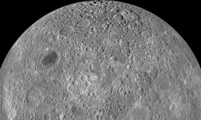
What’s on the far side of the moon? Not darkness.
-

 Business6 days ago
TikTok faces a ban in the US, Tesla profits drop and healthcare data leaks
-
 Business6 days ago
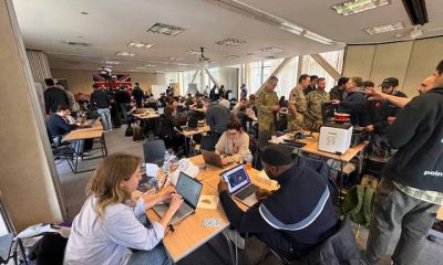
London’s first defense tech hackathon brings Ukraine war closer to the city’s startups
-

 Entertainment7 days ago
How to watch ‘The Idea of You’: Release date, streaming deals
-

 Entertainment6 days ago
Mark Zuckerberg has found a new sense of style. Why?
-

 Business5 days ago
Humanoid robots are learning to fall well
-

 Entertainment5 days ago
2024 summer TV preview: 33 TV shows to watch this summer
-

 Business4 days ago
Google Gemini: Everything you need to know about the new generative AI platform